Free Shipping – Store Wide
GPS Land Meter, Handheld GPS for Surveying, Professional Land Surveying Equipment,Gnss Receiver Surveryor Tool with Color Screen for Slope Distance/Area Measurement
GPS Land Meter, Handheld GPS for Surveying, Professional Land Surveying Equipment,Gnss Receiver Surveryor Tool with Color Screen for Slope Distance/Area Measurement
Brand: Generic
A$240.15
Availability:
-
This item is currently not available
Shop with confidence
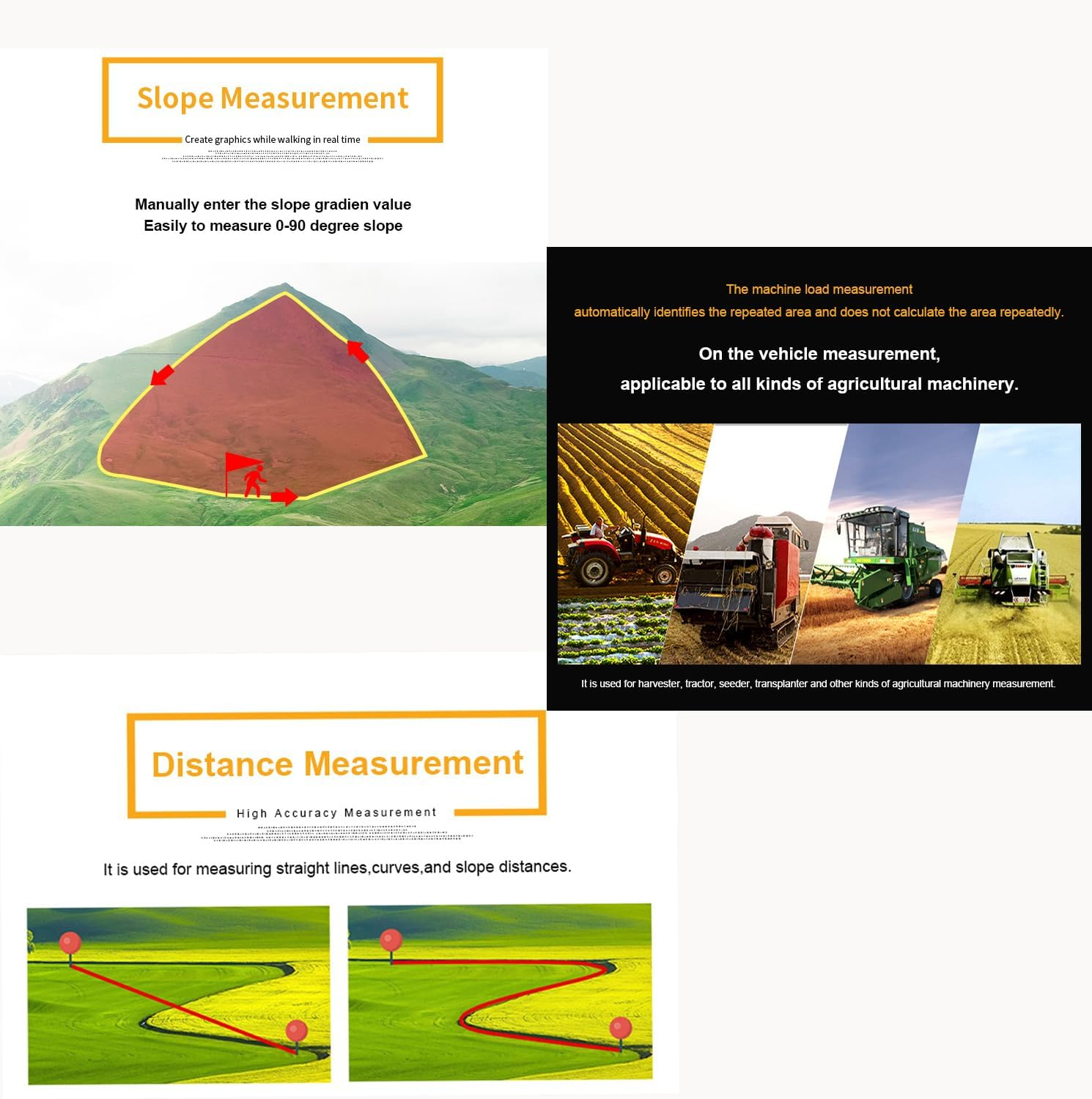
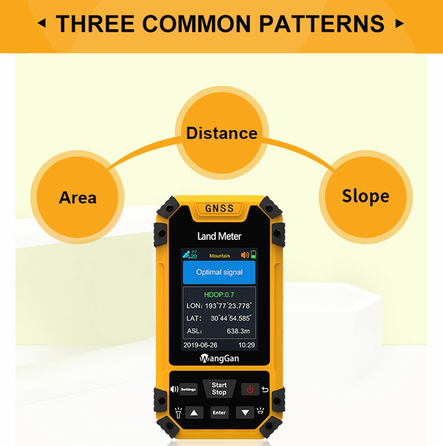
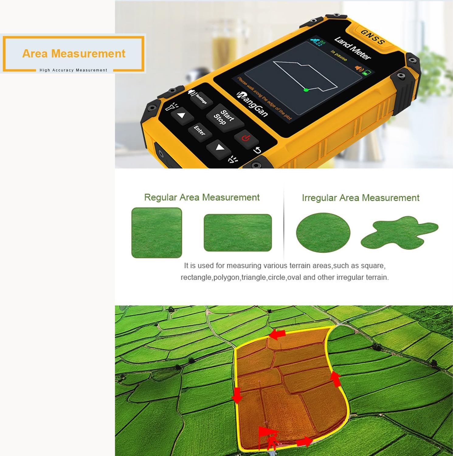
- Multiple Measurement Methods: Supports four measurement modes including area measurement (normal, length width, fixed width, fixed point), distance measurement (normal, fixed point, inclined distance), airborne measurement (rotating airborne, round trip airborne), and slope measurement (ordinary slope, smart slope, mountain) for enhanced accuracy
- Precise Measurement: Equipped with a measurement-grade high sensitivity GNSS receiver chip, utilizing a six-star system with global coverage. Combining barometer and GPS dual satellite positioning for intelligent slope and mountain measurement, ensuring precise height measurement. Accuracy is maintained even in areas without mobile phone signals outdoors
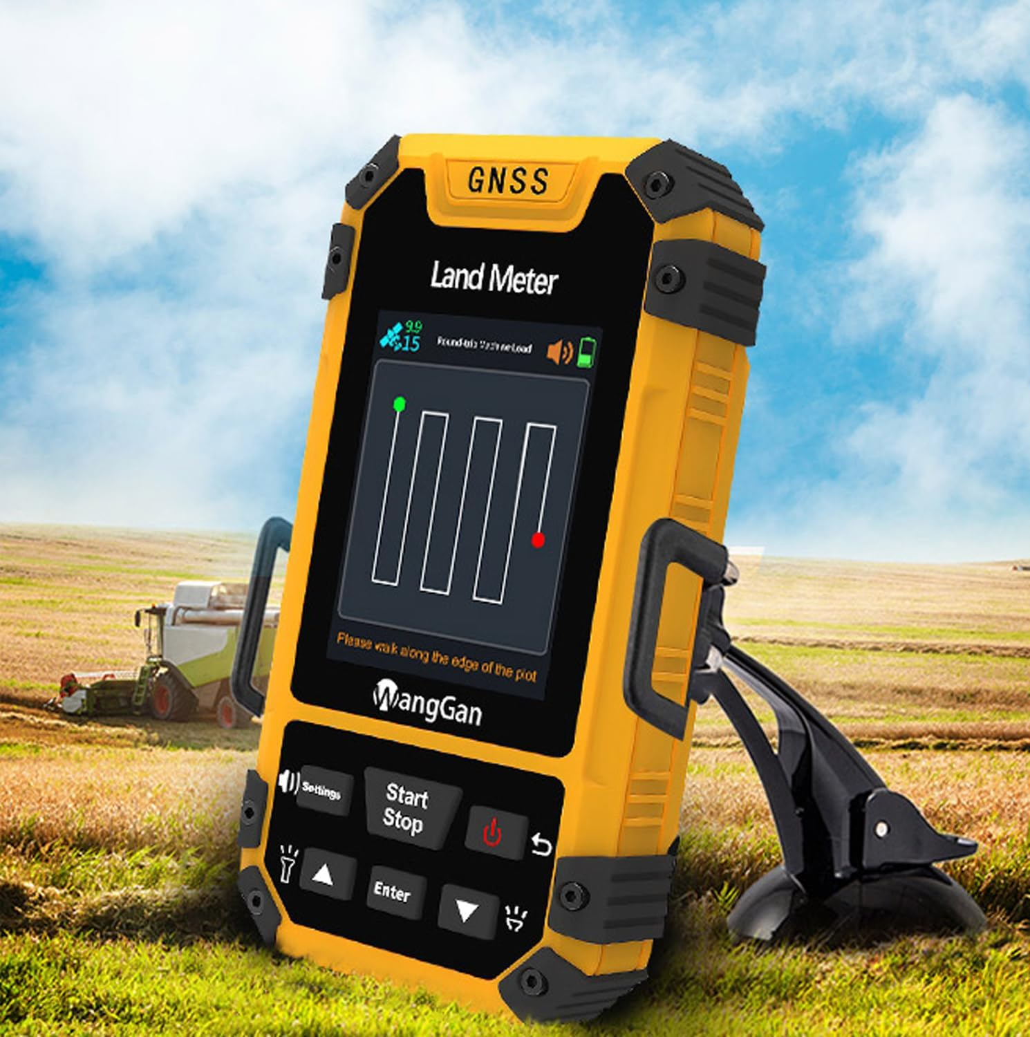
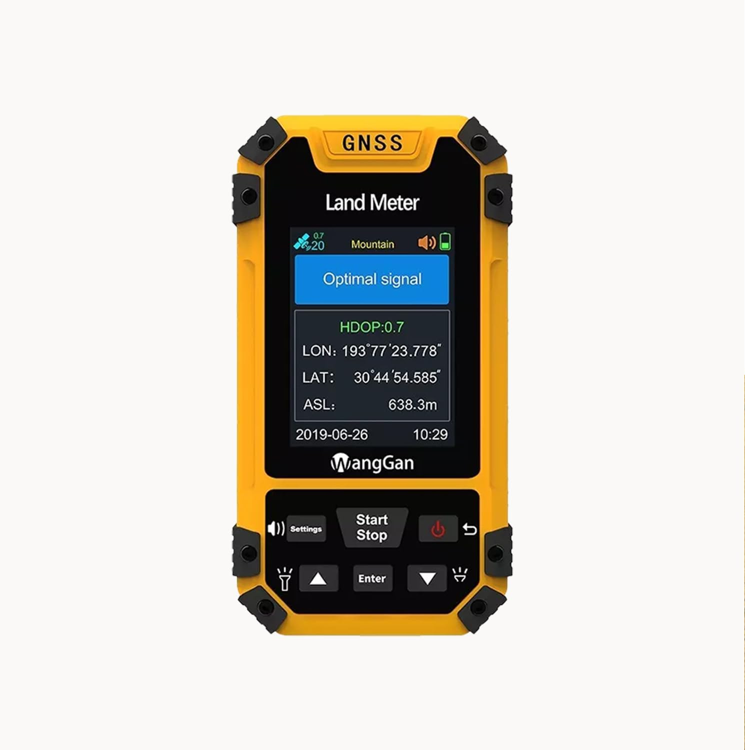
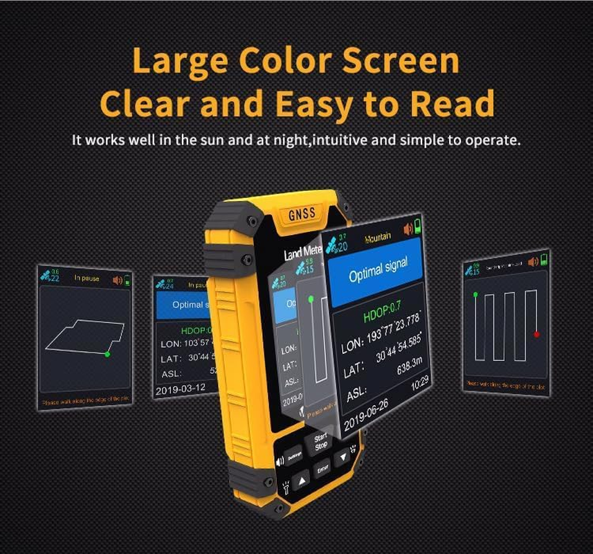
- LCD Clear Color Screen: Features a 2.4-inch screen designed for easy viewing in sunlight, providing a simple and elegant display with clear visibility. Functional features include latitude and longitude display, altitude display, area measurement, distance measurement, and land price calculation. Data statistics include area statistics and distance statistics
- Voice Prompts & User Friendly Design: The land meter offers real-time voice prompts in English at a high volume for clear guidance, even in noisy environments. Designed with large keys for easy use, making navigation simple for all users
- Real-time Measurement Report and Large Data Storage: This land measure meter allows you to view trajectory graphics in real time during use and access saved graphics in the records. Data can be easily exported for analysis and storage. It saves and records up to 199 historical data and figure tracks, which can be viewed, inquired about, and deleted at any time. Additionally, it includes auxiliary functions such as currency detection, convenient for daily use
- Rechargeable Battery & Industrial Grade Safety: This handheld GPS land surveying machine is built with an 1800mAh lithium battery that is rechargeable and can be connected to external mobile power supplies via a USB data cable. It features an industrial-grade three-proof process, making the land meter waterproof, dustproof, and shockproof for long-lasting durability
- Wide Application: Suitable for use in farmland, grassland, forests, water bodies, beaches, factories, and mines, among others. Widely used in agriculture, forestry, water conservancy, land management and taxation, agricultural machinery loading, and other fields
FEATURE
Area Measurement (normal, length width, fixed width, fixed point)
Distance Measurement (normal, fixed point, inclined distance)
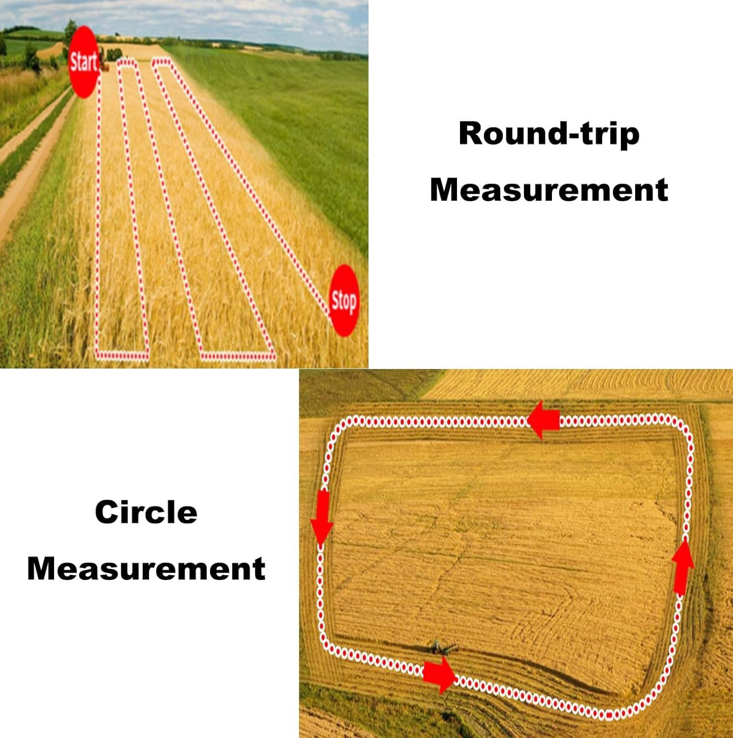
Airborne Measurement (rotating airborne, round trip airborne)
Slope Measurement (ordinary slope, smart slope, mountain)
Latitude and Longitude Display
Altitude Display
Real-time Trajectory Display
Land Price Calculation
Currency Detection
Data Export
Built-in Barometer
Flashlight
Data Export
SPECIFICATION
Receiver Chip: High-sensitivity GNSS receiver chip
Satellite System: Supports six-star satellite system
Efficient Startup: 1 second hot startup and 30 seconds cold startup
Area Accuracy: ±0.02 acres (1 to 3 acres), ±1% (above 3 acres) (when accuracy is less than 1.0)
Distance Accuracy: ±1 meter (when accuracy is less than 1.0, within a range of 100 meters)
Height Measurement Accuracy: ±1 meter (barometer measurement, absolute altitude requires calibration)
Data Statistics: Area statistics, distance statistics
Area Records: 200 records
Distance Records: 200 records
Waterproof and Dustproof: IP65
Battery Capacity: 1800mAh
Screen Display: Color screen (2.4 inches)
Sound Prompt: Voice broadcast
Working Time: 18 hours
Working Temperature: -20°C to +70°C
Data & Charging Interface: USB port
Color: Orange and Black
Device Weight: 180 grams
Device Dimensions: 117*61*22mm
PACKAGE
1 x Land Surveying Instrument (including 1 lithium battery)
1 x USB Cable
1 x Lanyard
1 x User Manual
- Item Weight: 260 g
- Batteries: 1 AAA batteries required. (included)
- Country of origin: China
- Package Dimensions: 14 x 7.5 x 5.5 cm; 260 Grams
- Manufacturer: Follow FBA Rules
A$240.15
Shipping to Australia
Delivery time varies by location
Return & Refund Policy
Check our return & refund policy
Security & Privacy
Safe payments: We do not share your personal details
Availability:
-
This item is currently not available
Sign in
or create an eMega account
Shop smarter — get exclusive deals & order tracking