Free Shipping – Store Wide
USA Western Railroads and Highways Travel Reference Map 1:1.7M
USA Western Railroads and Highways Travel Reference Map 1:1.7M
A$78.80
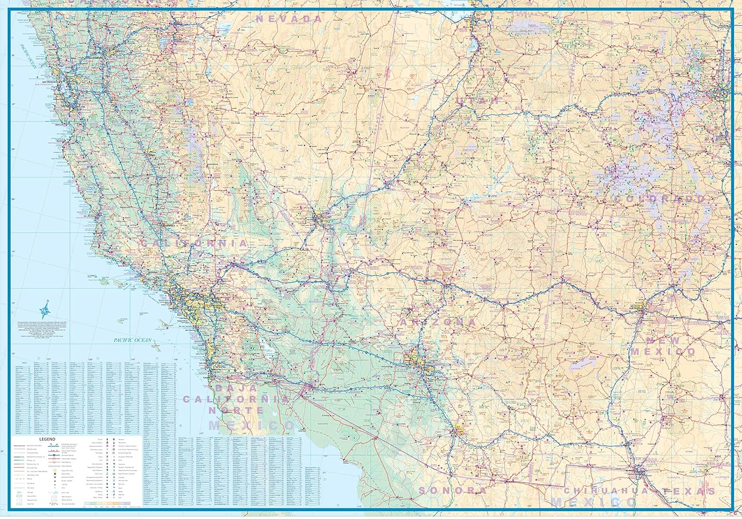
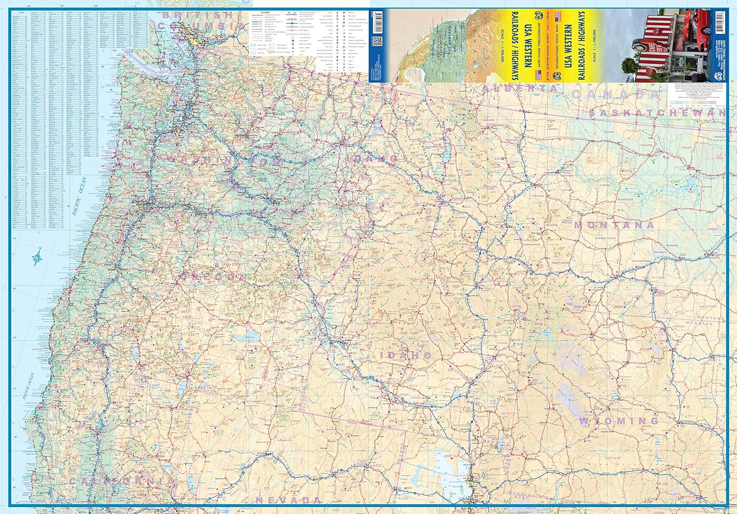
This is also a new title for ITMB, replacing our former map called USA West Half. This map does not cover the same area exactly, nor is it at the same scale, but more importantly, its purpose has changed. Travel in the USA is changing. The younger generation is increasingly travelling by train and bus to get from place to place, as airfares rise and the cost of a car becomes more expensive. At first, we thought of doing an AMTRAK/VIA Rail map of North America, but the resultant scale would have reduced detail to an unacceptable level, so we opted to convert the concept of a map of half a country into a map thematically attempting to concentrate on travel by rail around at least a large portion of America. The motorways, highways, and touristic attractions are still shown, but the passenger service rail lines a shown prominently. This is a double-sided north-south map, with side one showing from Vancouver south to Red Bluff in California and east to Casper, Wyoming. The other side covers from north of Sacramento, California to the Mexican border and from the Pacific shore east to Denver or El Paso. This covers a goodly portion of the USA at a better scale than our previous edition, with the same attention to touristic detail as one the earlier map.
- Publisher: ITMB Publishing
- Dimensions: 10.2 x 0.5 x 24.7 cm
- Language: English
- Print length: 2 pages
- Item weight: 52 g
- Book Type: Map
- ISBN-10: 1771298448
- ISBN-13: 978-1771298445
- Publication date: 1 April 2016
A$78.80
Shipping to Australia
Delivery time varies by location
Return & Refund Policy
Check our return & refund policy
Security & Privacy
Safe payments: We do not share your personal details
Availability:
-
In Stock
Sign in
or create an eMega account
Shop smarter — get exclusive deals & order tracking