Free Shipping – Store Wide
England'S Victorian Maps: Thomas Moule'S County and City Maps
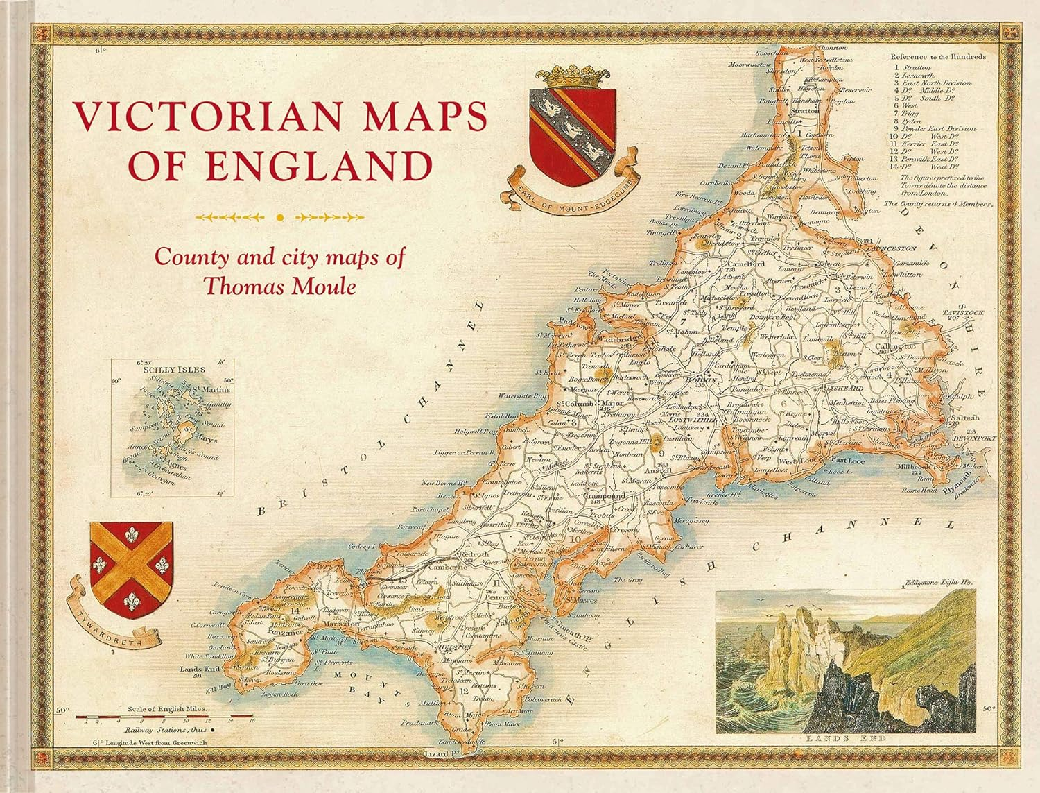
England'S Victorian Maps: Thomas Moule'S County and City Maps
A$70.05
Availability:
-
This item is currently not available
Shop with confidence
The most beautiful Victorian maps of England's counties and cities by one of Britain's great cartographer's Thomas Moule.
For the first time in a generation, the maps of the mid-19th century are reproduced to a very high standard in a large-format book. The maps are fascinating, decorative and hugely informative of an England in transformation with industrialization and the burgeoning railways. The 60 maps cover the counties of England plus key cities and are accompanied by contemporary descriptions as well as extracts on the counties from the Victorian age. It explores and explains Moule's career and development as a mapmaker and positions him alongside fellow celebrated Victorian pioneers including Brunel, Wedgewood, Bradshaw, Turner, Pugin, Blake, Scott and Wordsworth.
Thomas Moule (1784-1851) is the finest Victorian mapmaker and is regarded as the true follower of John Speed in the cartographic history of Britain. Moule's beautifully observed county and city maps present a minutely detailed record of nineteenth-century England whilst also celebrating its 'ancientness' and history through pastoral or monument views all of which are framed within the cartouches, festoons and architecural ornament of the time. All, however, also show the progress of the Industrial revolution. The maps have remained most influential and highly collectable in both original and as reproductions.
- Publisher: Batsford GB
- Dimensions: 31.75 x 1.93 x 40.64 cm
- Language: English
- Print length: 144 pages
- Book Type: Hardcover
- ISBN-10: 1849944970
- ISBN-13: 978-1849944977
- Publication date: 18 January 2019
A$70.05
Shipping to Australia
Delivery time varies by location
Return & Refund Policy
Check our return & refund policy
Security & Privacy
Safe payments: We do not share your personal details
Availability:
-
This item is currently not available
Sign in
or create an eMega account
Shop smarter — get exclusive deals & order tracking